Update: 5 am, Friday, January 20:
This Hazardous Weather Outlook is for the counties served by the National Weather Service Office in Birmingham.
Day One: Outlook through Friday night
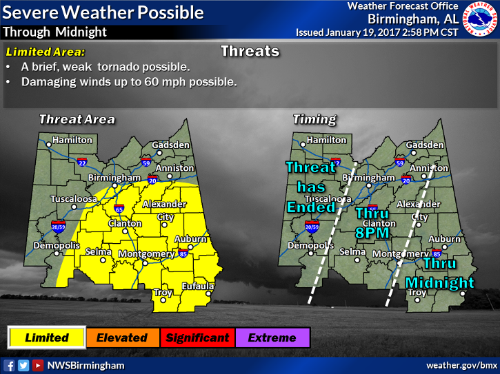
Severe storms are possible across the Southeastern portions of the area tonight, generally after 3 am. The threat area is roughly south and west of a line from Reform, To Tuscaloosa, to Centreville, to Selma. The primary threat will be damaging straight line winds, but an isolated tornado cannot be ruled out.
Days two through seven: Saturday through Thursday.
Severe storms are possible across all of Central Alabama Saturday morning, with the highest threat south of I-20. All modes of severe weather will be possible including large hail, damaging wind and tornadoes. There will likely be a lull in the activity Saturday afternoon, but if any storms manage do develop, they could be severe. Another round of severe storms is possible across Central Alabama Saturday night into Sunday morning, with the greatest threat along and south of Interstate 85. All modes of severe weather will be possible including large hail, damaging winds and tornadoes.
***
The National Weather Service in Birmingham has updated their forecast for our area with an eye towards possible severe weather midnight Friday through Saturday. The Hazardous Weather Outlook includes Lee County. Multiple rounds of potentially severe and tornadic weather are in the forecast. Be weather aware and follow the local forecasts.
Thursday evening forecast calls for the most potential to occur after midnight. Weather will deteriorate through Friday evening and the largest threat of severe weather will be from 3 am Friday morning through noon Saturday. All forms of severe weather are possible, strong winds, large hail and tornadoes. We could see a lull Saturday afternoon, but if storms develop they could be severe through Sunday morning.
All of Opelika, Auburn and Lee County are in the Elevated category for severe weather during this period.
We will update this story as the forecast is updated. Be sure to follow your local weather and be prepared to take shelter in severe weather.
